Index of /blogs/wp-content/blogs.dir/42/files/370
Name
Last modified
Size
Description
Parent Directory
-
o_Mapa Vegetacion Venezuela.jpg
2010-01-15 17:48
7.0M
o_Mapa Vegetación de Venezuela_ve1.jpg
2010-01-15 17:48
7.0M
o_Geológico del Brasil ESB-ISRIC.jpg
2010-01-15 17:48
5.6M
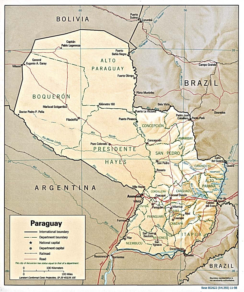
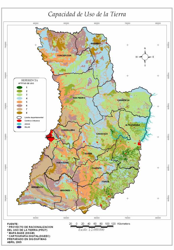
o_Paraguay Mapa de Suelos ISRIC ESB.jpg
2010-01-15 17:48
3.0M
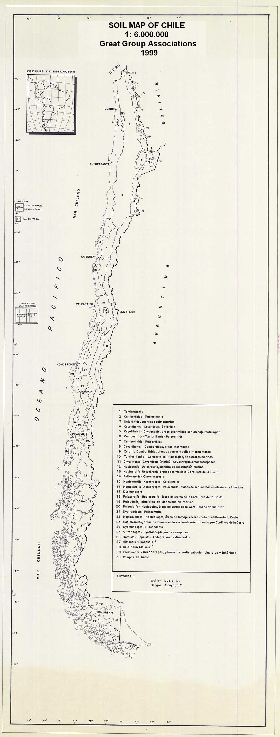
o_Chile_topo_es.PNG
2010-01-15 17:48
2.8M
o_Mapa Agroecológico de Brasil.jpg
2010-01-15 17:48
2.7M
o_Mapa ecol Brasil ESB-ISRIC.jpg
2010-01-15 17:48
2.3M
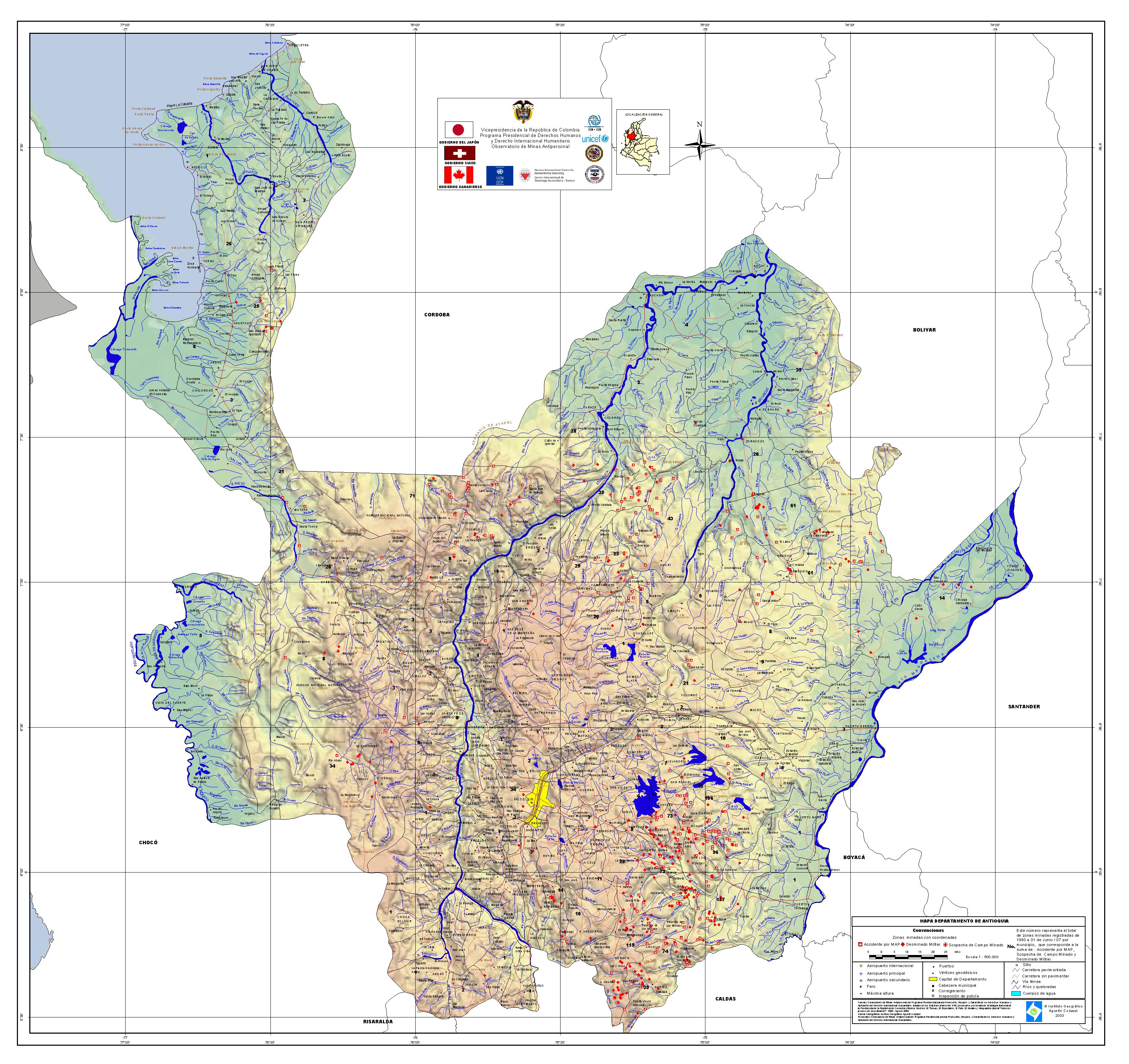
o_antioquiaminas.jpg
2010-01-15 17:48
1.9M
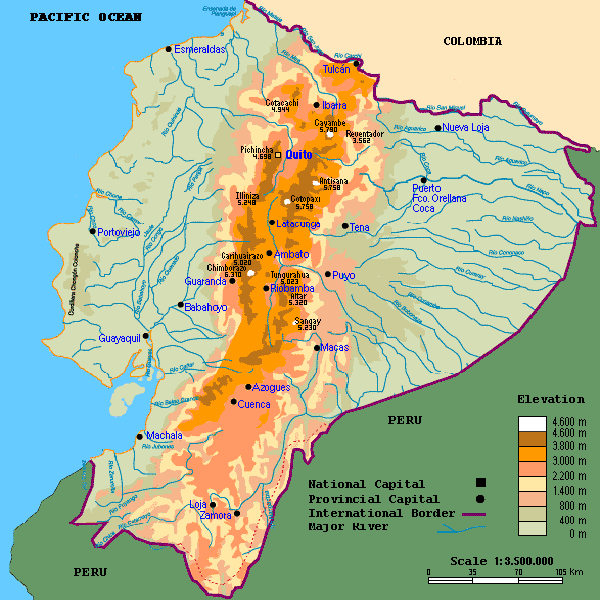
o_Ecuadorr Mapa SuelosPeque.png
2010-01-15 17:48
1.7M
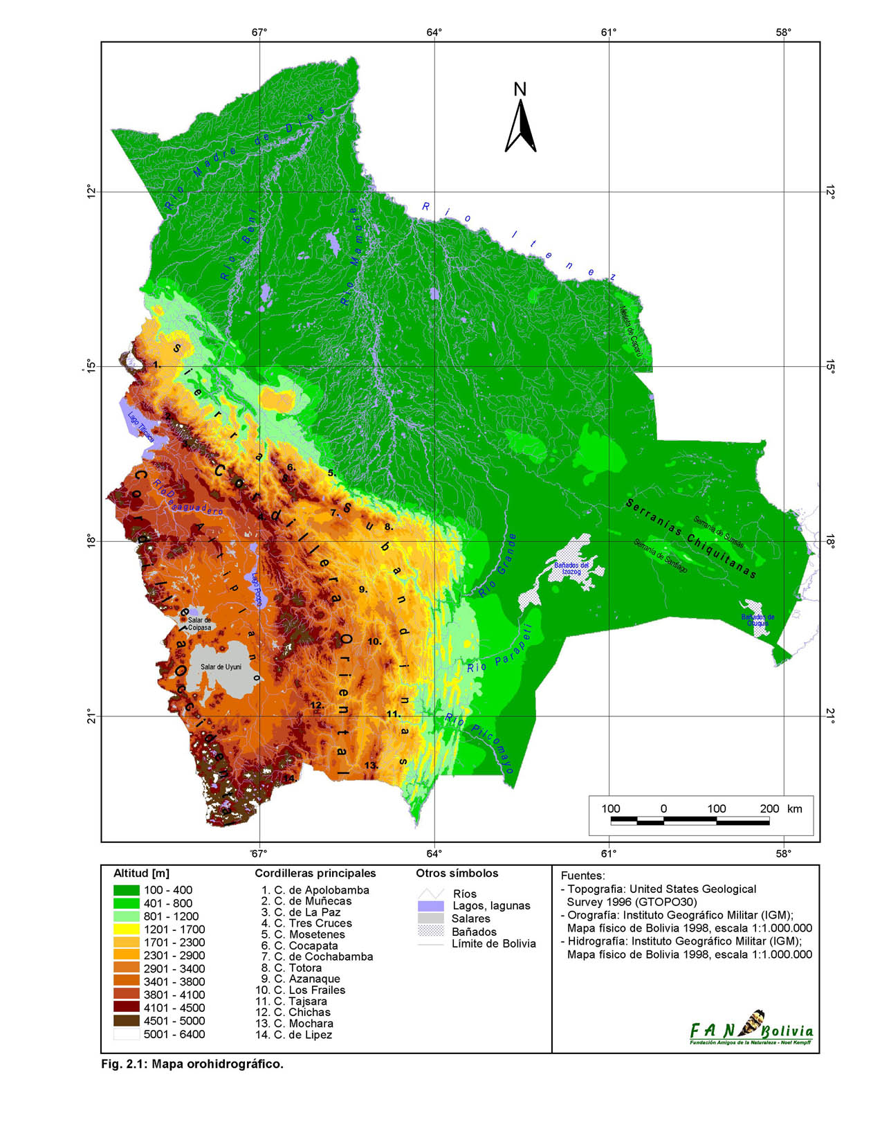
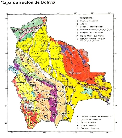
o_Bolivia Mapa Relieve.png
2010-01-15 17:48
1.5M
o_Mapa Suelo Chile web de su congreso.PNG
2010-01-15 17:48
1.5M
Histosoles-Irlanda.jpg_backup
2024-07-19 17:33
1.5M
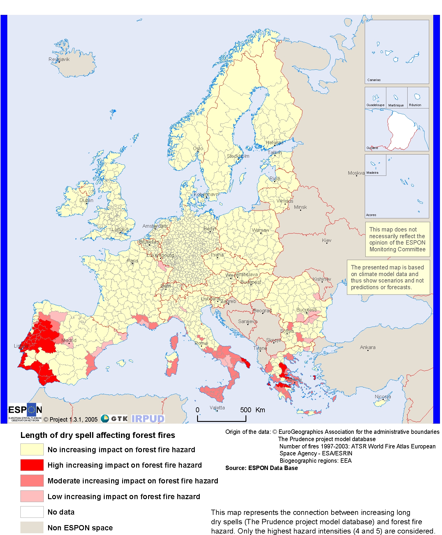
o_Incendios forestrales.jpg
2010-01-15 17:48
1.4M
o_World Soils.bmp
2010-01-15 17:48
1.4M
caebonatos-a-2-m.jpg_backup
2024-04-29 17:37
1.3M
Histosoles-Irlanda.jpg
2024-07-19 17:33
1.3M
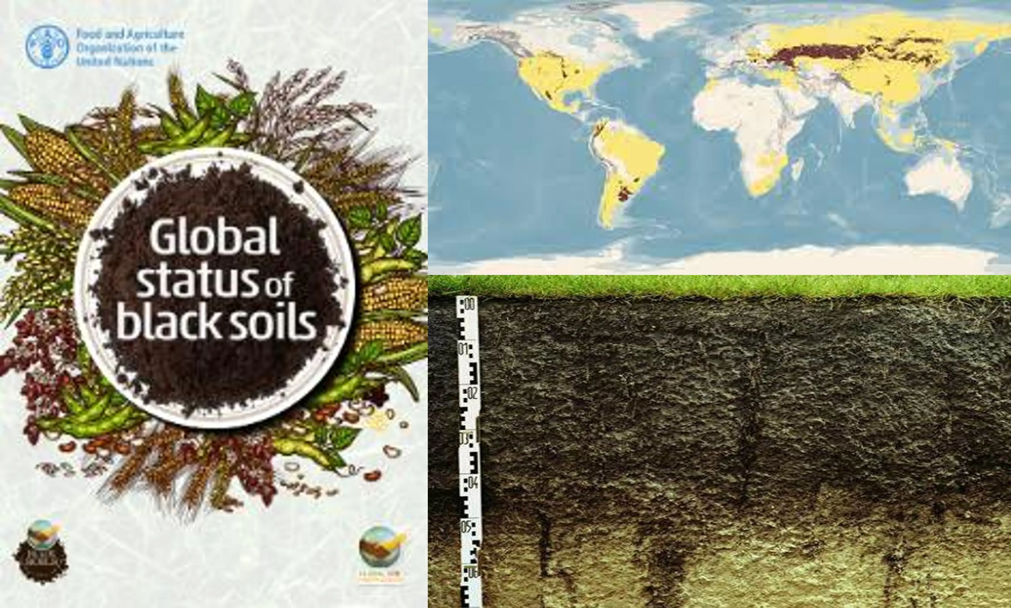
Suelos-Negros-FAO-2022.jpg_backup
2022-12-31 17:57
1.3M
o_Brasil Mapa Vegetac Embrapa.png
2010-01-15 17:48
1.2M
caebonatos-a-2-m.jpg
2024-04-29 17:37
1.2M
o_Global soil regions map table.jpg
2010-01-15 17:48
1.2M
o_Bolivia Mapa Ecoregiones.png
2010-01-15 17:48
1.1M
Permafrost-desastre.jpg_backup
2022-07-04 15:34
1.1M
Suelos-Negros-FAO-2022.jpg
2022-12-31 17:57
1.1M
Atlas-Suelos-Asia.jpg_backup
2023-08-23 16:59
1.1M
o_Bolivia mapas clima.png
2010-01-15 17:48
1.1M
Permafrost-desastre.jpg
2022-07-04 15:34
1.1M
Atlas-Suelos-Asia.jpg
2023-08-23 16:59
1.1M
o_Argentina Susana1.png
2010-01-15 17:48
1.1M
o_Argentina11.png
2010-01-15 17:48
1.1M
gelisoles-criosoles-Tibet.jpg_backup
2023-07-12 17:16
1.0M
o_Bolivia mapa de suelos2.png
2010-01-15 17:48
1.0M
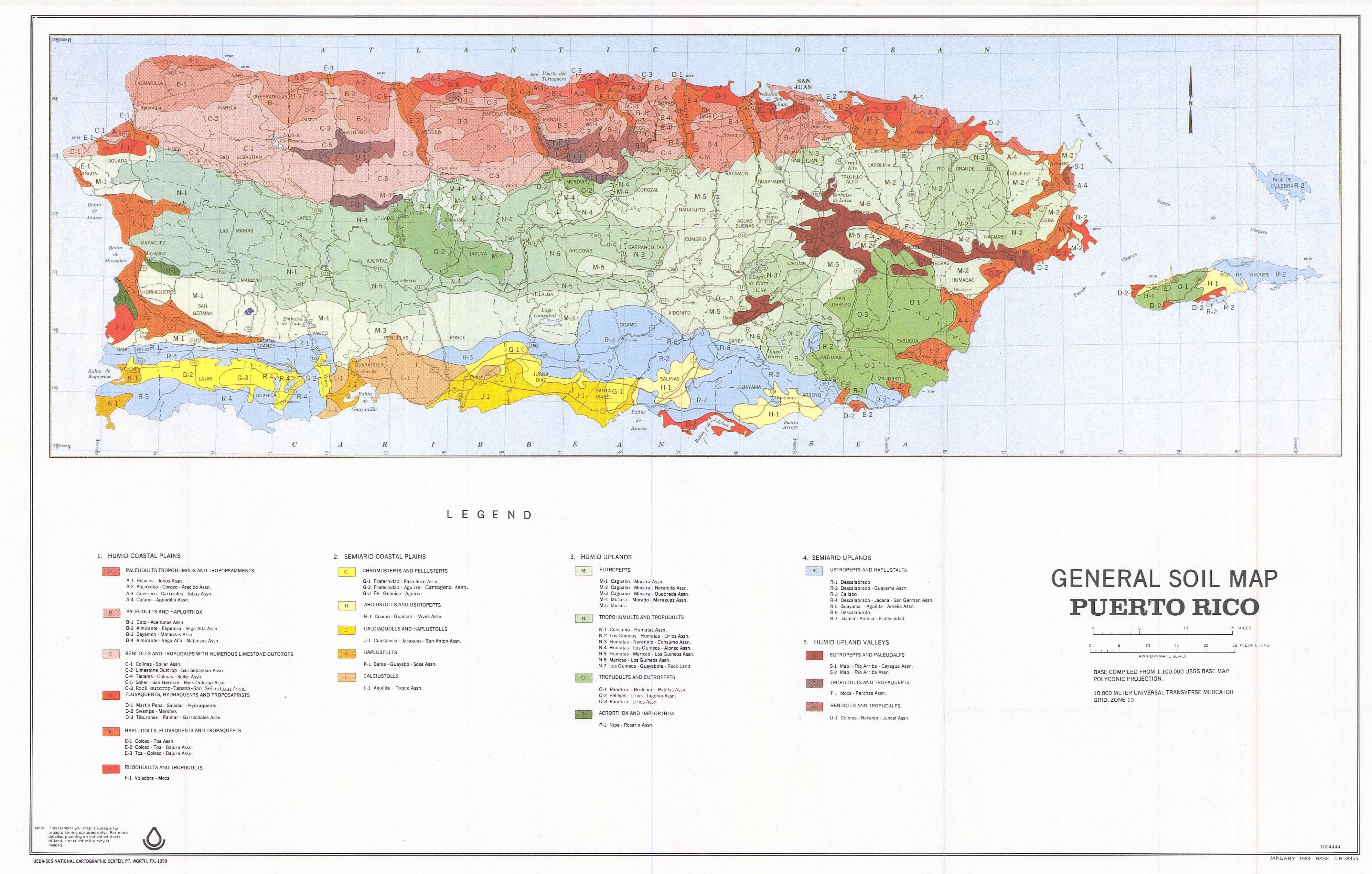
o_soil_map Puerto Rico.jpg
2010-01-15 17:48
1.0M
gelisoles-criosoles-Tibet.jpg
2023-07-12 17:16
951K
Yucatan-suelos-paisajes.jpg_backup
2022-06-16 17:00
888K
permafrost-bajo-nieve.jpg_backup
2023-08-28 17:11
850K
Yucatan-suelos-paisajes.jpg
2022-06-16 17:00
828K
permafrost-bajo-nieve.jpg
2023-08-28 17:11
803K
Australia-carbono-en-el-suelo.jpg_backup
2023-06-04 16:54
747K
Turberas-conservacion.jpg_backup
2025-02-24 13:32
723K
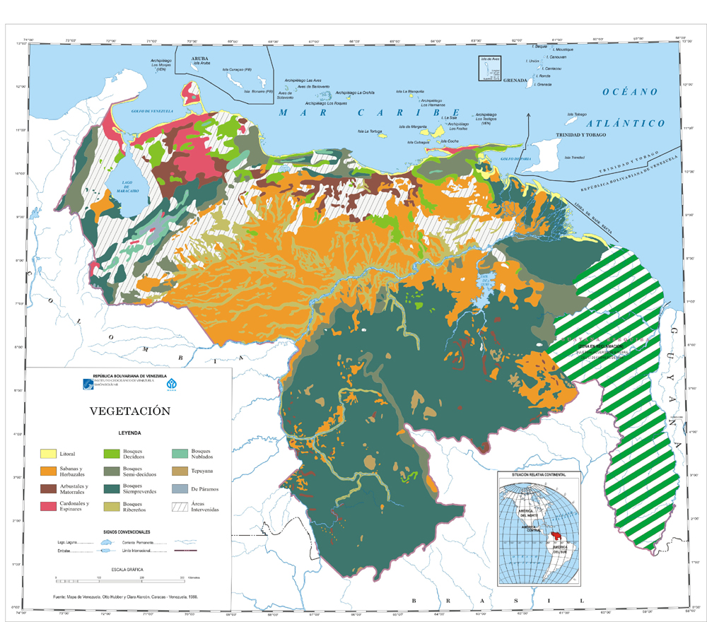
o_venezuela mapas vegetacion.jpg
2010-01-15 17:48
719K
Suelos-Santiago-de-Chile.jpg_backup
2023-01-06 17:11
718K
o_Vegetación natural de Guyana.jpg
2010-01-15 17:48
704K
Flujo-co2-escala-continental.jpg_backup
2023-04-06 17:55
692K
Turberas-conservacion.jpg
2025-02-24 13:32
690K
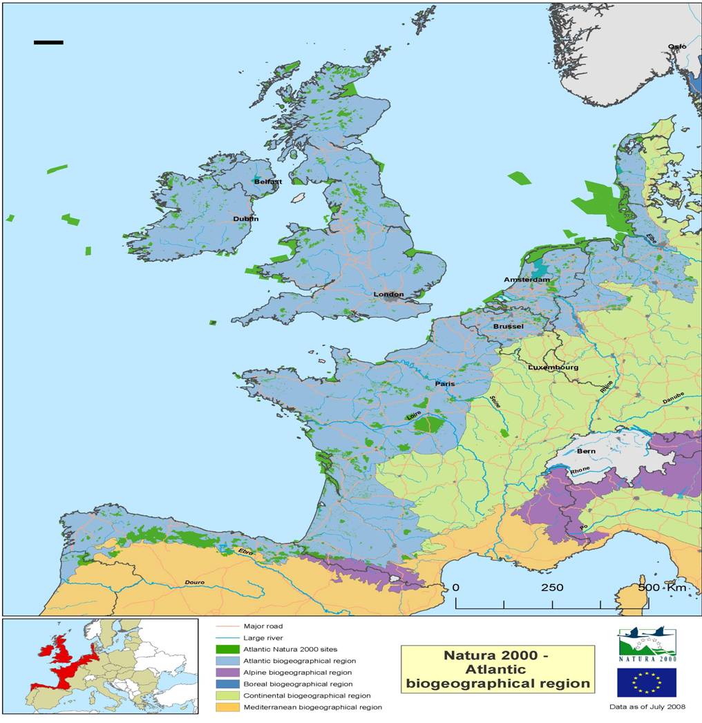
o_atlantic EEA.JPG
2010-01-15 17:48
687K
o_Mapa Suelos Colombia Leyenda.png
2010-01-15 17:48
675K
Australia-carbono-en-el-suelo.jpg
2023-06-04 16:54
669K
Suelos-Santiago-de-Chile.jpg
2023-01-06 17:11
665K
Flujo-co2-escala-continental.jpg
2023-04-06 17:55
658K
o_mediterranean EEA MAp.jpg
2010-01-15 17:48
621K
o_venezuela_mapas_suelos2.jpg
2010-01-15 17:48
620K
Histosoles-Irlanda.jpg.webp
2024-07-19 17:33
613K
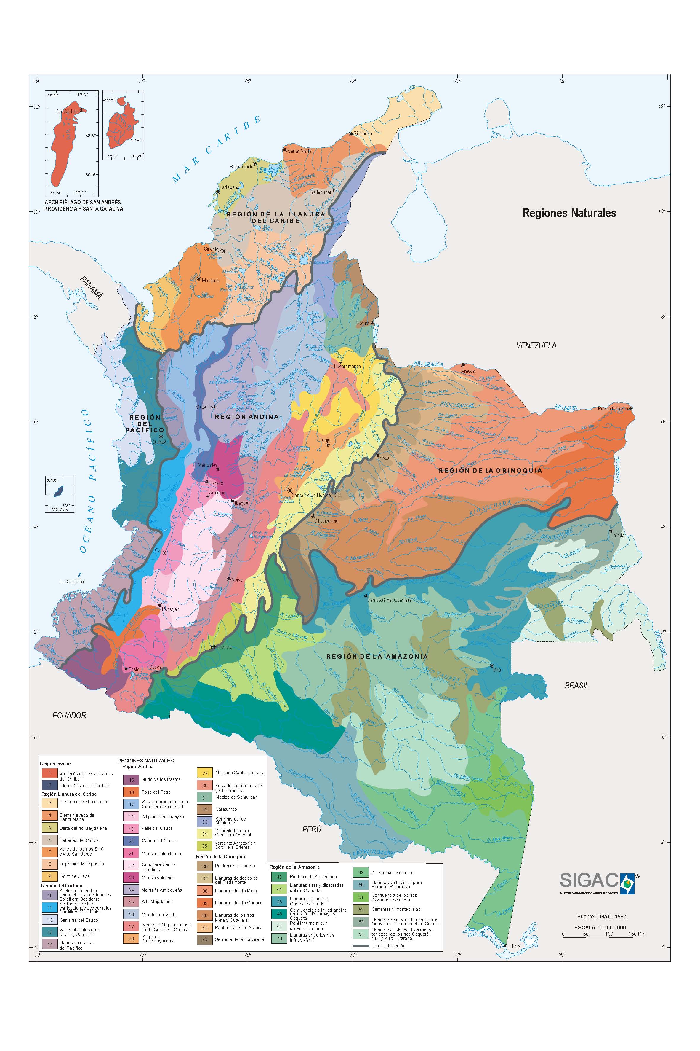
o_Regiones Naturales Colombia IGAC.jpg
2010-01-15 17:48
601K
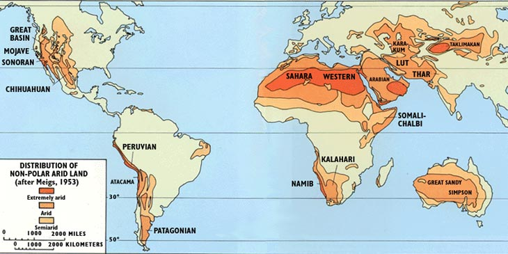
o_Mapa de Aridez de Latinoamárica.jpg
2010-01-15 17:48
592K
o_Rio urguay Wikipedia.png
2010-01-15 17:48
579K
ASia-Atlas-Suelos.jpg_backup
2023-12-26 15:00
557K
caebonatos-a-2-m.jpg.webp
2024-04-29 17:37
552K
o_atlantic EEA MAP.jpg
2010-01-15 17:48
543K
permafrost-fuente-esa-movie-frostmap2011_0.gif
2011-12-27 15:21
537K
permafrost-fuente-esa-movie-frostmap2011.gif
2011-12-19 16:17
537K
permafrost-fuente-esa-frostmap20111126_l.gif
2011-12-19 16:14
537K
permafrost-distribution-in-the-arctic-large-source-wunderground-punto-com.png
2012-05-08 15:23
534K
ASia-Atlas-Suelos.jpg
2023-12-26 15:00
529K
o_Estépica.jpg
2010-01-15 17:48
443K
o_Argentina33.png
2010-01-15 17:48
438K
Permafrost-desastre.jpg.webp
2022-07-04 15:34
436K
Atlas-Suelos-Asia.jpg.webp
2023-08-23 16:59
432K
o_map_aridland mismo que el otro.PNG
2010-01-15 17:48
424K
o_Panónica EEA.jpg
2010-01-15 17:48
412K
o_Peru Wikipedia.png
2010-01-15 17:48
384K
Suelos-Negros-FAO-2022.jpg.webp
2022-12-31 17:57
368K
Yucatan-suelos-paisajes.jpg.webp
2022-06-16 17:00
360K
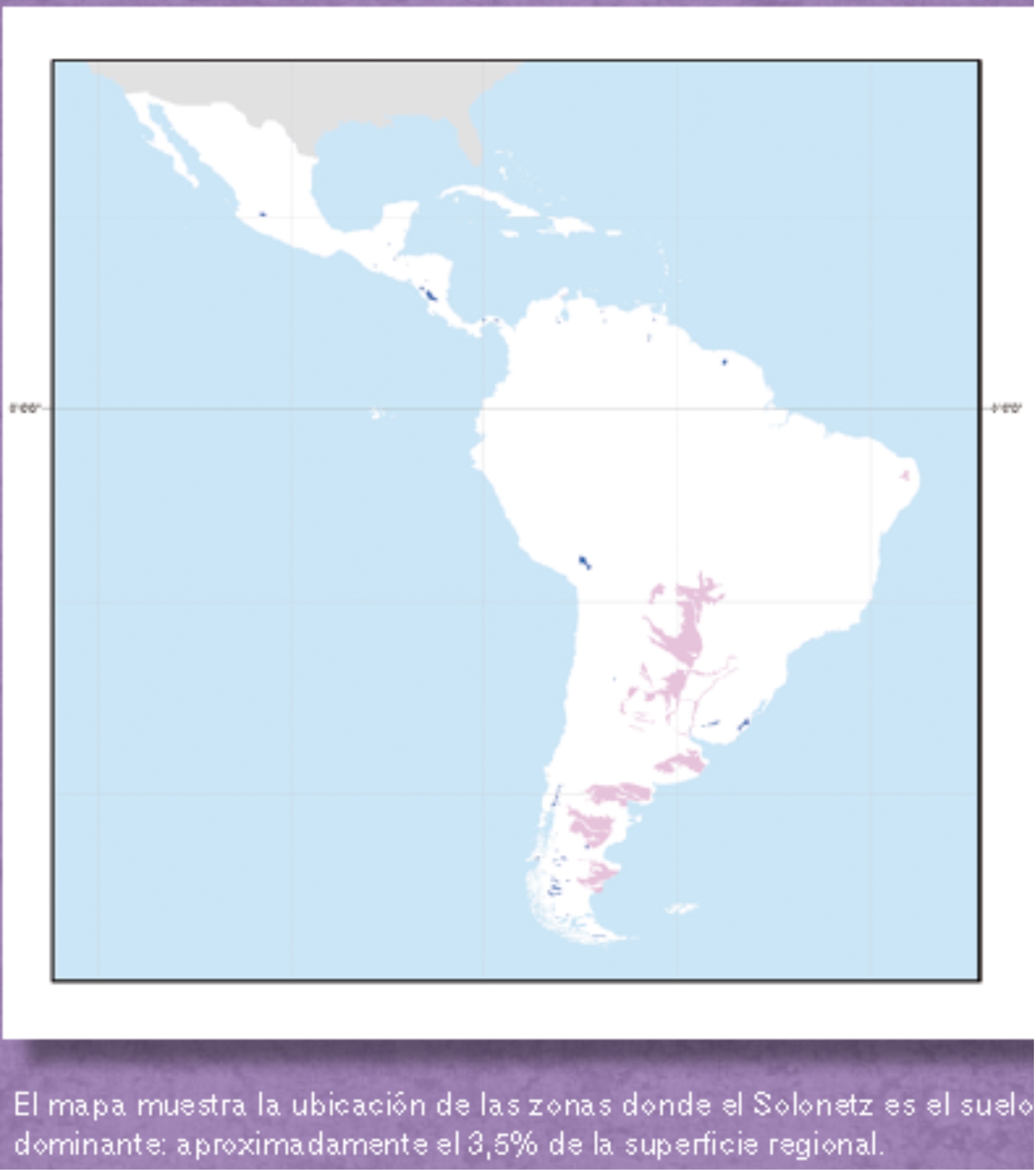
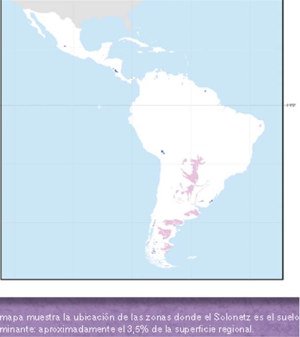
solonetz-mapa-la-calendario-esb-2012.jpg
2013-12-28 14:46
359K
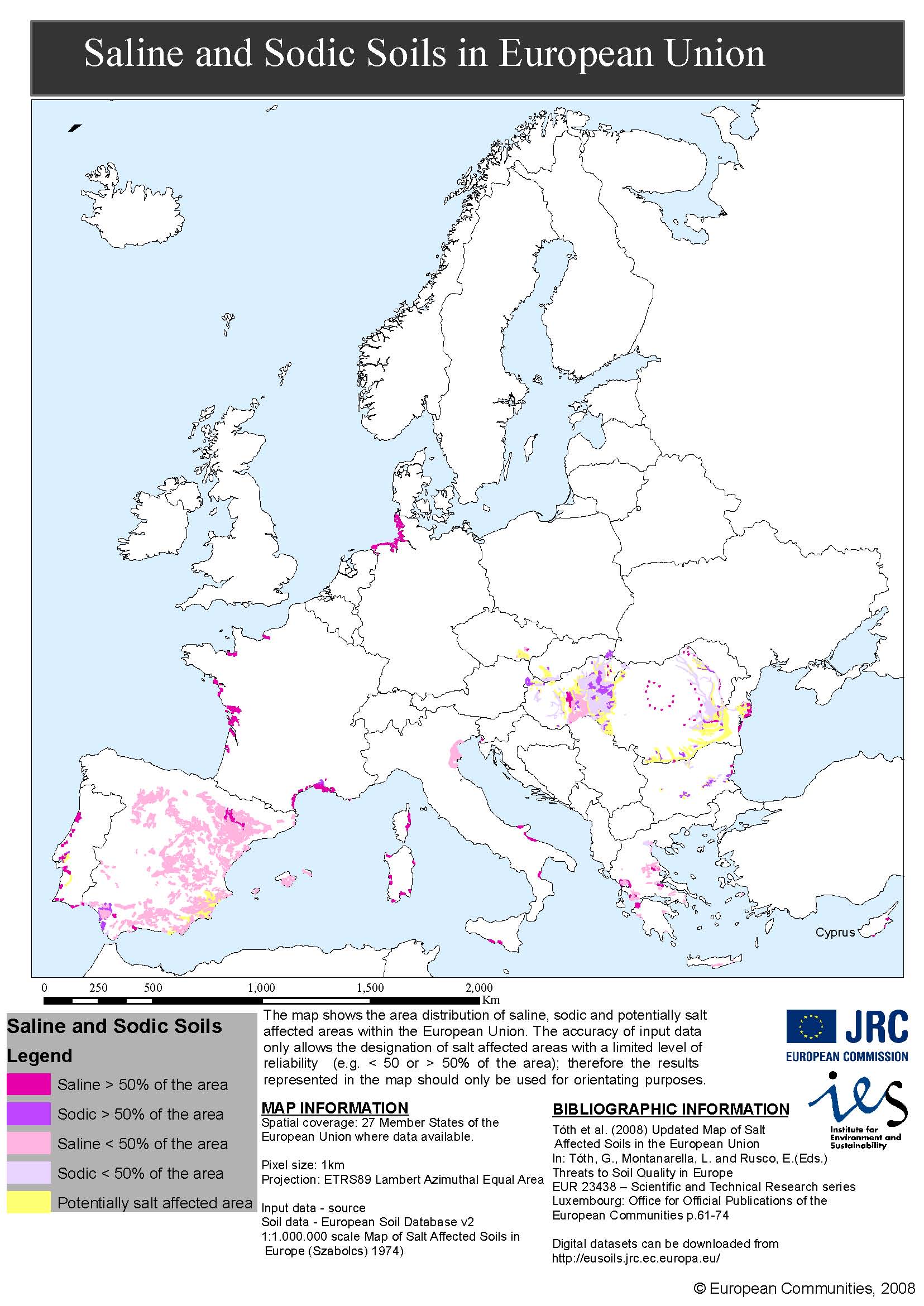
saline-and-sodic-soils-in-europe-esb-jrc.jpg
2013-12-30 15:43
359K
plintosoles-en-la-esb_0.jpg
2013-03-01 15:23
348K
plintosoles-en-la-esb.jpg
2013-03-01 15:21
348K
plintosoles-en-la-esb_1.jpg
2013-03-01 15:27
344K
o_paraguayRelieve Wiki.jpg
2010-01-15 17:48
336K
o_black_sea EEA Map.jpg
2010-01-15 17:48
335K
o_australial Ola de Calor.jpg
2010-01-15 17:48
331K
gelisoles-criosoles-Tibet.jpg.webp
2023-07-12 17:16
321K
permafrost-bajo-nieve.jpg.webp
2023-08-28 17:11
318K
o_Pangea_animation_03.gif
2010-01-15 17:48
309K
vertisols-usda-buscando-google-por-clay-rich-landscapes-vertisols.jpg
2011-08-09 15:31
305K
Mapa-de-los-suelos-negros-del-Mundo-GSP.jpg_backup
2022-06-14 16:13
300K
o_Mapa vegetacion de Colombia.jpg
2010-01-15 17:48
300K
o_Circumboreales WRB.jpg
2010-01-15 17:48
295K
Mapa-de-los-suelos-negros-del-Mundo-GSP.jpg
2022-06-14 16:13
289K
Australia-carbono-en-el-suelo.jpg.webp
2023-06-04 16:54
287K
o_Cirumboreales rusia.jpg
2010-01-15 17:48
285K
o_Cincumboreales usa.jpg
2010-01-15 17:48
279K
Suelos-Santiago-de-Chile.jpg.webp
2023-01-06 17:11
276K
o_Peru Erosion INRENA.jpg
2010-01-15 17:48
276K
o_Cincumboreales canada.jpg
2010-01-15 17:48
270K
o_Geografía de Suelos.png
2010-01-15 17:48
264K
Turberas-conservacion.jpg.webp
2025-02-24 13:32
262K
mapa-de-suelos-escala-1-25-000-y-su-leyenda-fuente-generalitat-de-catalunya.jpg
2011-03-15 17:05
259K
o_800px-Plate_tectonics_map Wijipedia Inglés.gif
2010-01-15 17:48
245K
o_Sapropel Mediterráneaosalinidad.PNG
2010-01-15 17:48
243K
o_Biomes busqueda america.jpg
2010-01-15 17:48
233K
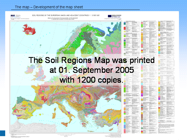
o_Soil regions of Europe.jpg
2010-01-15 17:48
232K
Flujo-co2-escala-continental.jpg.webp
2023-04-06 17:55
230K
o_Uruguay Relieve Wikipedia.png
2010-01-15 17:48
228K
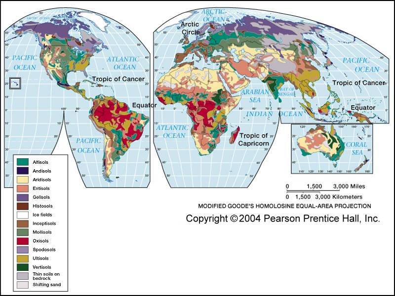
o_Global soil Regions NRCS orders.jpg
2010-01-15 17:48
217K
o_Panonia Wikipedia.jpg
2010-01-15 17:48
213K
o_canarias1.jpg
2010-01-15 17:48
204K
o_Soil_atlas.jpg
2010-01-15 17:48
204K
o_barbados.gif
2010-01-15 17:48
200K
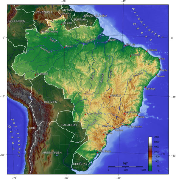
o_Brazil_climate_map Wikipedia.jpg
2010-01-15 17:48
199K
o_Worldgeothumb.gif
2010-01-15 17:48
198K
o_Peru Mapa de Suelos.jpg
2010-01-15 17:48
197K
o_Peru Regionales Ambientales.jpg
2010-01-15 17:48
197K
ASia-Atlas-Suelos.jpg.webp
2023-12-26 15:00
192K
o_eurasia biomes busqueda biomes america.jpg
2010-01-15 17:48
188K
o_Mapa Suelos Brasil Nuevo.jpg
2010-01-15 17:48
186K
mexico-mapa-de-suelos-principles-fuente-inegi.gif
2012-10-12 16:17
178K
o_Mapa de Suelos de Mejico.jpg
2010-01-15 17:48
168K
o_Mapa suelos de Venezuela.jpg
2010-01-15 17:48
168K
o_Biomes northamerica busqueda america.jpg
2010-01-15 17:48
166K
o_Biomas 5 piramide_20biomas.jpg
2010-01-15 17:48
166K
monitorizaci%c3%b3n-del-parmafrost-con-el-tiempo-fuente-tiempo-com-meteored_0.jpg
2011-12-19 16:18
166K
monitorizaci%c3%b3n-del-parmafrost-con-el-tiempo-fuente-tiempo-com-meteored.jpg
2011-12-19 16:13
166K
o_550.jpg
2010-01-15 17:48
160K
o_map_soil_moisture_regimes.jpg
2010-01-15 17:48
160K
o_La escasez de Agua en Blog CAM EL Agua Febrero 2007 o_escasezagua1.png
2010-01-15 17:48
158K
o_Argentina22.png
2010-01-15 17:48
153K
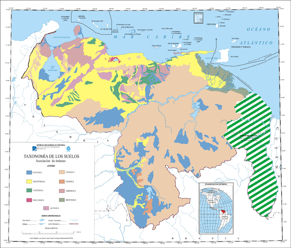
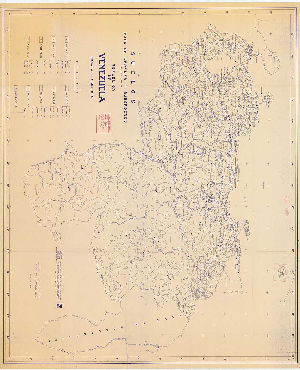
mapa-de-ordenes-y-subordenes-de-venezuela.jpg
2011-03-12 20:04
151K
drylandmap-fuente-ocean-world.jpg
2014-01-04 14:03
150K
suelos-de-cuba-2.jpg
2012-01-15 16:51
149K
o_vegetacion de Europa.jpg
2010-01-15 17:48
148K
o_mapa_solos Brasil Embrapa.jpg
2010-01-15 17:48
144K
o_Mapa de Suelos de Colombia IGAC.jpg
2010-01-15 17:48
143K
o_Maximo gaciar 14000 aÑOS.jpg
2010-01-15 17:48
139K
o_Mapa Suelos USA generalizado.jpg
2010-01-15 17:48
135K
o_Relieve de Europa.jpg
2010-01-15 17:48
134K
o_macaronesia Gobierno de Canarias.gif
2010-01-15 17:48
131K
o_Atlantic 2EEA.jpg
2010-01-15 17:48
129K
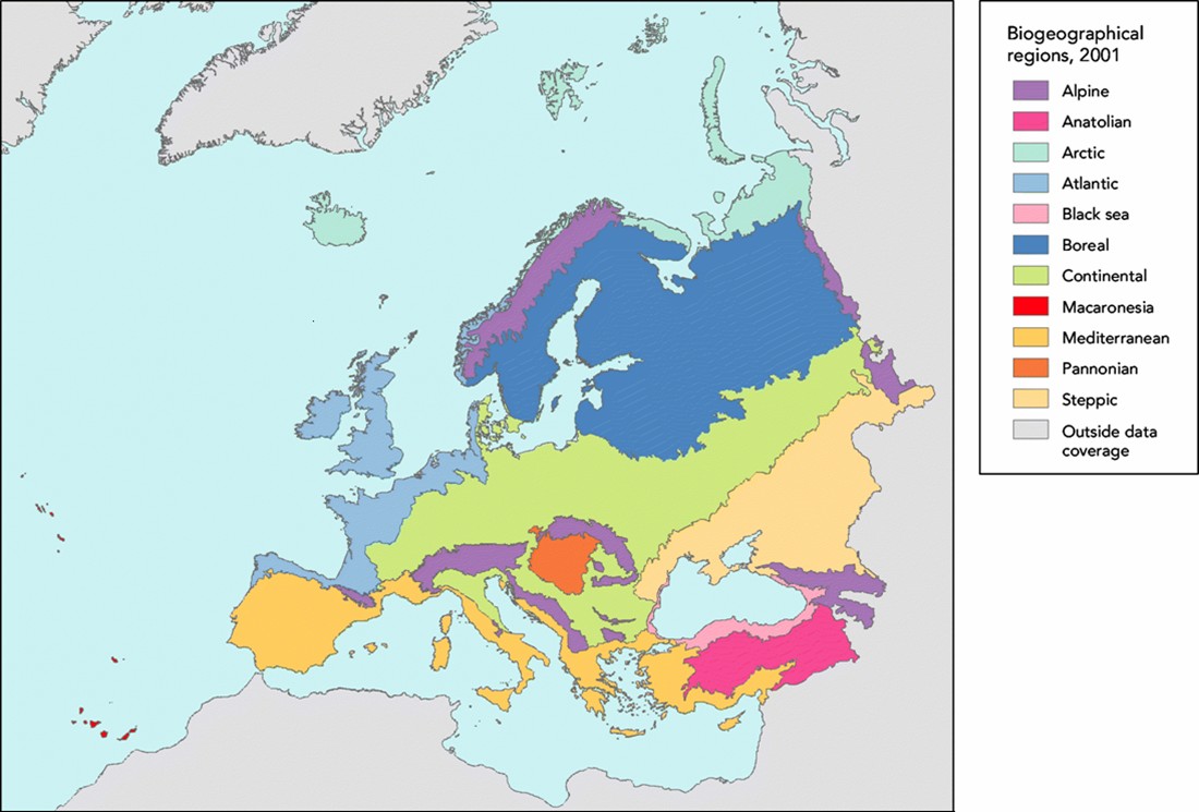
o_Regiones Biogeograf Europa y Turq.jpg
2010-01-15 17:48
127K
o_Mapa Mundial Climas.png
2010-01-15 17:48
126K
o_TheWorldDubai.jpg
2010-01-15 17:48
124K
o_Corriente Noratlantica.jpg
2010-01-15 17:48
118K
o_Interglacial world map Wikieeng.png
2010-01-15 17:48
117K
o_Escudo Guayanés y relieve latin.gif
2010-01-15 17:48
116K
arctic-climate-scenarios.gif
2012-05-08 15:23
114K
monitorizacion-del-parmafrost-con-el-tiempo-fuente-tiempo-com-meteored_0.jpg
2011-12-27 15:20
113K
monitorizacion-del-parmafrost-con-el-tiempo-fuente-tiempo-com-meteored.jpg
2011-12-19 16:23
113K
monitorizaci%c3%b3n-del-parmafrost-con-el-tiempo-fuente-tiempo-com-meteored_1.jpg
2011-12-19 16:21
113K
cirmumpolar-soils.jpg
2011-08-02 17:55
111K
o_Uruguay muy pastorial FAO.jpg
2010-01-15 17:48
108K
o_Mapa paisajes Uruguay.gif
2010-01-15 17:48
106K
o_Relieve_Colombia.jpg
2010-01-15 17:48
104K
o_Paraguay Mapa de Suelos.jpg
2010-01-15 17:48
103K
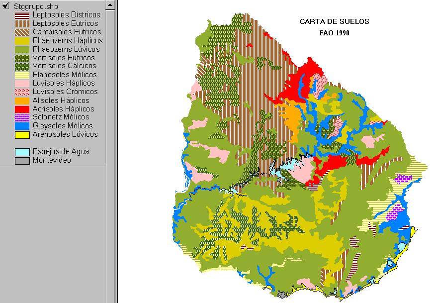
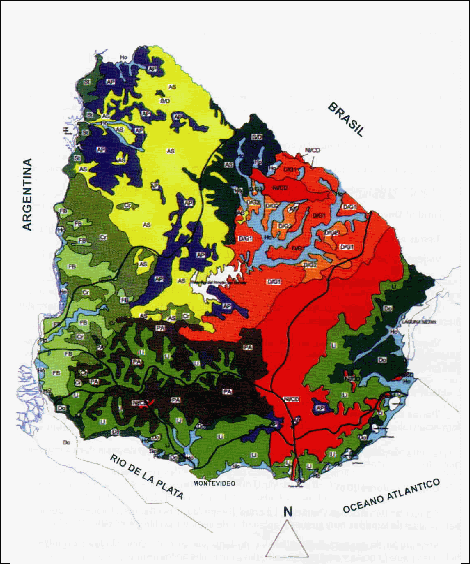
o_Mapa de Suelos de Uruguay.jpg
2010-01-15 17:48
103K
o_Brasil Fisiografia Wikipedia.jpg
2010-01-15 17:48
98K
Mapa-de-los-suelos-negros-del-Mundo-GSP.jpg.webp
2022-06-14 16:13
98K
o_Mapa de los Climas del Mundo.jpg
2010-01-15 17:48
98K
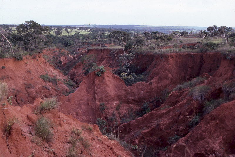
paisaje-erosionado-ferralsoles-carcavas-alain-ruellan.jpg
2013-02-20 19:41
98K
o_SOC MAP JRC.jpg
2010-01-15 17:48
97K
o_Danube_deltaWikipedia.jpg
2010-01-15 17:48
96K
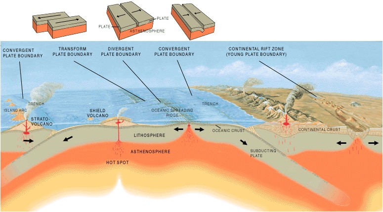
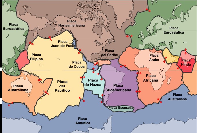
o_Tectonic_plate_boundaries Wiukipedia Inglés.jpg
2010-01-15 17:48
94K
o_NCRS Inorganic Carbon búsqueda por soil inorganic carbon.jpg
2010-01-15 17:48
93K
o_NCRS úsqueda soil inorganic carbon.jpg
2010-01-15 17:48
93K
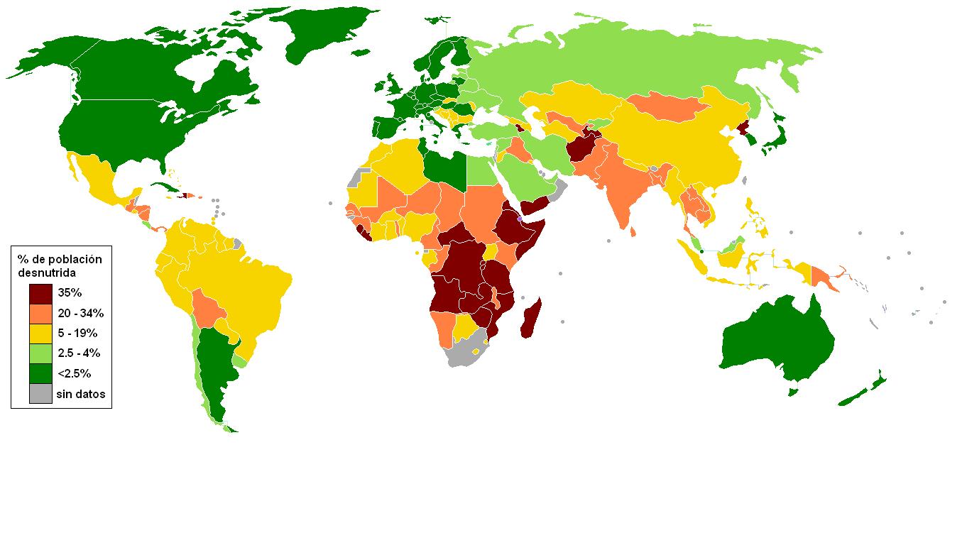
o_Hambre en el Mundo.JPG
2010-01-15 17:48
92K
o_World Soils.JPG
2010-01-15 17:48
91K
o_Diapositiva28.GIF
2010-01-15 17:48
91K
o_Pangea 3 Wikipedia Español.jpg
2010-01-15 17:48
91K
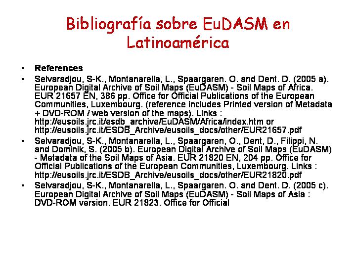
o_Referencias Bibliograficas EUDAMs Latinoamerica.JPG
2010-01-15 17:48
90K
o_Referencias Biblio EUDAMS Latinoamerica.JPG
2010-01-15 17:48
90K
o_Urugay Zonificación de ecosistemas.gif
2010-01-15 17:48
89K
o_bolivia_mapa_suelos.jpg
2010-01-15 17:48
89K
o_Biomas suelos y tectomas 1.JPG
2010-01-15 17:48
87K
o_Europe Cuencas Drenaje mapa.jpg
2010-01-15 17:48
87K
o_Escudo Guyanes Wiki.png
2010-01-15 17:48
85K
o_Mapa de Usos del Suelo Colombia Kalipedia.JPG
2010-01-15 17:48
84K
o_TurksandCaicosOMC.JPG
2010-01-15 17:48
84K
atlas-de-suelos-circimpolar-fuente-esb.jpg
2010-07-05 14:12
82K
o_World Soil Resources.jpg
2010-01-15 17:48
82K
o_Mapa Suelos Mundo FAO.jpg
2010-01-15 17:48
82K
phaeozem-europa-esb.jpg
2014-04-20 15:23
82K
geografia-mapas-del-mundo-de-las-arcillas-del-suelo.jpg
2016-04-01 14:55
81K
o_Paraguay Usos suelo.jpg
2010-01-15 17:48
81K
distribucion-de-praderas-marinas-en-el-mundo-fuente-teach-ocean-science.jpg
2012-06-07 14:52
80K
o_HWDSsoilmap.gif
2010-01-15 17:48
78K
mapa-de-vegetacion-fuente-geospatial-information-and-agriculture.gif
2011-03-17 20:30
77K
vulcanismo-mapa-mundo.jpg
2011-10-23 16:26
77K
o_Mapa de Relieve de El Salvador.jpg
2010-01-15 17:48
76K
o_Sapropel Mediterráneo.jpg
2010-01-15 17:48
76K
o_MapaBiomas Brasil Nuevo.jpg
2010-01-15 17:48
76K
francisco-montoriol-y-luis-alcala.jpg
2020-08-21 15:53
74K
o_El Salvador Mapa Cobertura del Suelo.gif
2010-01-15 17:48
73K
mapa-geologico-fuente-natural-resources-canada.jpg
2011-03-17 20:29
73K
o_Suelos Urbanos.jpg
2010-01-15 17:48
73K
o_dominantesoiw Fuente FAo WRB.gif
2010-01-15 17:48
73K
o_Laurasia y Godwana Wikipedia Inglés.jpg
2010-01-15 17:48
72K
o_legenda Mapa Suelos Brasil Embrapa.jpg
2010-01-15 17:48
72K
o_Soil Atlas of Europe.jpg
2010-01-15 17:48
72K
o_Europa Satélite.jpg
2010-01-15 17:48
72K
o_Argentina55.png
2010-01-15 17:48
71K
o_Mapa de Suelos de El Salvador.jpg
2010-01-15 17:48
70K
latinoamarica-fao-sdoil-groups-suelos-de-latinoamerica-fuente-encyclopaedia-britannica.gif
2010-05-26 14:47
70K
o_Maditerranean sapropel map.PNG
2010-01-15 17:48
69K
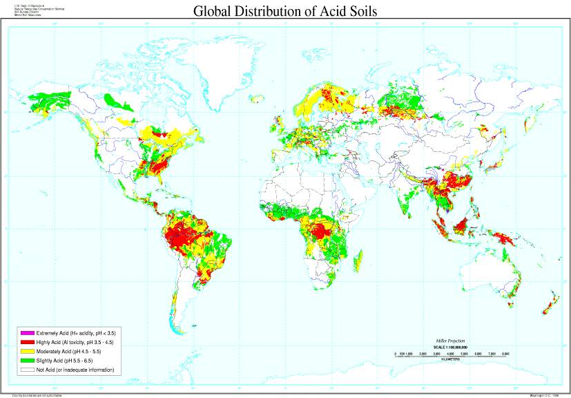
o_Global Distribution Acid Soils WSDgeneticcontrolfig1.jpg
2010-01-15 17:48
68K
o_Distribution Acid Soils WSDgeneticcontrol.jpg
2010-01-15 17:48
68K
alisol-fuente-isric.jpg
2012-03-24 14:15
68K
francisco-monturiol-luis-alalaca-y-angel-recogiendo-un-monolito_0.jpg
2020-08-21 15:47
67K
francisco-monturiol-luis-alalaca-y-angel-recogiendo-un-monolito.jpg
2020-08-21 15:45
67K
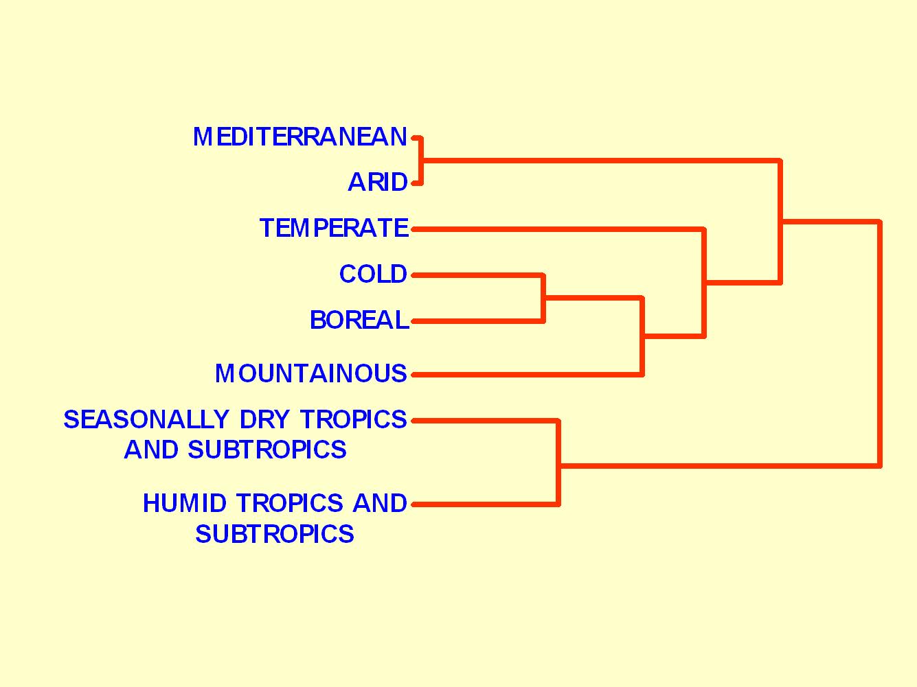
o_Biomas Dendrograma Geoder.jpg
2010-01-15 17:48
66K
o_Brasil Cuencas Hidrográficas Wikipedia.jpg
2010-01-15 17:48
66K
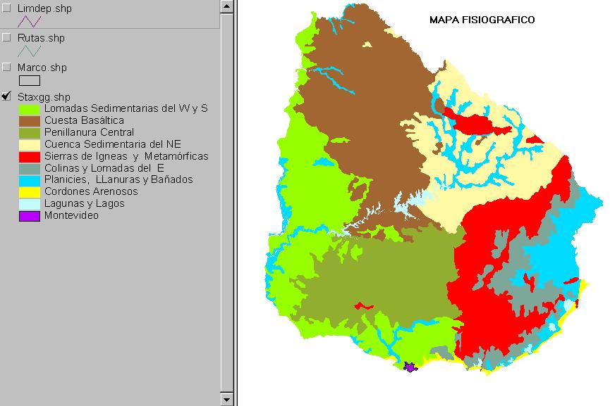
o_Mapa fiosográfico Urugay.jpg
2010-01-15 17:48
64K
o_Catenas Latitudinales en Montañas.jpg
2010-01-15 17:48
63K
o_Cryosol World Map.gif
2010-01-15 17:48
62K
mapa-de-suelos-de-latinoamerica.jpg
2013-11-02 20:23
62K
o_Biomas Gradiente lat.jpg
2010-01-15 17:48
62K
possidnia-world-map-unep-distribution-of-coral-mangrove-and-seagrass-diversity_30dc.jpg
2012-06-07 14:53
60K
o_Regiones suelos Uruguay.jpg
2010-01-15 17:48
60K
o_globalfertility.jpg
2010-01-15 17:48
60K
arable-land-ans-sic-in-the-world.jpg
2016-01-22 15:37
59K
o_porosity world Map.jpg
2010-01-15 17:48
59K
o_relieve de argentina y submarino.jpg
2010-01-15 17:48
59K
mapa-de-solos-igo-lepsch.jpg
2015-07-25 14:26
58K
o_map_aridland.jpg
2010-01-15 17:48
57K
mapa-de-suelos-fuente-nrcs.jpg
2011-03-17 20:31
57K
o_Mapa de Textura de los suelos del mundo.jpg
2010-01-15 17:48
57K
pinguinos-guano-gas-de-la-risa.jpg
2020-06-03 19:30
57K
o_relieve venezuela mipuntopuntocom.gif
2010-01-15 17:48
57K
mapa-de-ordenes-de-los-suelos-de-venezuale-fuente-vision-agroecologica.gif
2011-03-12 20:05
56K
o_Climas de Ecuador.JPG
2010-01-15 17:48
56K
deshielo-permafrost.jpg
2021-12-19 13:55
55K
o_Climas de Europa Kalipedia.JPG
2010-01-15 17:48
55K
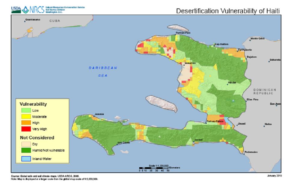
mapa-de-vulnerabilidad-a-la-desertificacion-en-haiti-usda-nrc.jpg
2010-03-20 16:50
54K
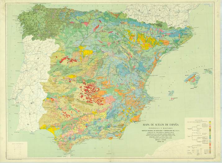
mapa-de-suelos-de-espana-monturiol-guerra.jpg
2020-08-21 15:54
54K
o_Biomas del Mundo II.JPG
2010-01-15 17:48
53K
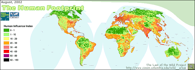
o_El antropoceno smhumanFootprint.gif
2010-01-15 17:48
53K
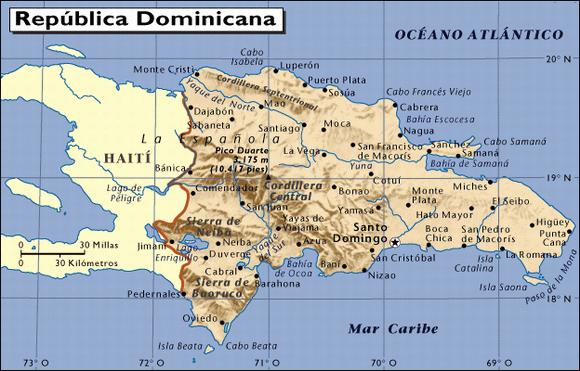
o_republica_dominicana.JPG
2010-01-15 17:48
52K
o_Zonas Agroecol Urygay.jpg
2010-01-15 17:48
52K
o_Mapa Glaciaciones.jpg
2010-01-15 17:48
52K
alcala-y-monturiol.jpg
2020-08-21 16:12
52K
mapa-de-isolineas-fuente-wikipedia.jpg
2011-03-12 20:03
52K
o_Diapositiva2.JPG
2010-01-15 17:48
52K
o_Diapositiva1.JPG
2010-01-15 17:48
52K
mollisol-world-map.jpg
2014-01-18 14:30
52K
o_biomas busca biomas en google.jpg
2010-01-15 17:48
51K
o_Climas del Mundo Mapa 2.JPG
2010-01-15 17:48
51K
o_Chile templada fria humededa.PNG
2010-01-15 17:48
50K
o_Mapa Usos Suelo y Zonas vida El Salvador.jpg
2010-01-15 17:48
50K
o_ecuador reg nat Exploring Ecuador.jpg
2010-01-15 17:48
50K
reconocimiento-de-suelos-usa.jpg
2018-11-07 18:09
49K
o_Chile árida semiarida subum.PNG
2010-01-15 17:48
49K
o_Mapa suelos de El Salvador.jpg
2010-01-15 17:48
49K
suelos-principales-la-soter-calendario-2012-esb.jpg
2012-01-17 16:41
49K
o_making new continents assembly.jpg
2010-01-15 17:48
49K
o_Mapa permafrost.jpg
2010-01-15 17:48
49K
mapa-de-suelos-de-haiti-subordenes-usda-nrcs.jpg
2010-03-20 16:49
48K
arenosol-vertisol.jpg
2014-12-25 16:01
47K
o_EU Soil Map Figure1.jpg
2010-01-15 17:48
46K
o_Baltic Sea Wikipedia.JPG
2010-01-15 17:48
46K
o_Rodinia1 Protolaurasia Wiki inglés.jpg
2010-01-15 17:48
46K
o_Biomas suelos y tectomas 4.jpg
2010-01-15 17:48
46K
o_Trinidad and Tobago erosion map.gif
2010-01-15 17:48
45K
chenozem-kastanozem-paheozems.jpg
2014-01-16 15:38
45K
mapas-y-diversidades.jpg
2011-03-17 20:32
45K
o_Continentes2.jpg
2010-01-15 17:48
45K
o_ArgMundo_g.jpg
2010-01-15 17:48
44K
o_ecuador relieve.gif
2010-01-15 17:48
44K
o_Diapositiva20.GIF
2010-01-15 17:48
44K
o_Regiones Biogeograficas Europa.JPG
2010-01-15 17:48
43K
atlas-suelos-latinoamerica.jpg
2014-02-22 15:11
43K
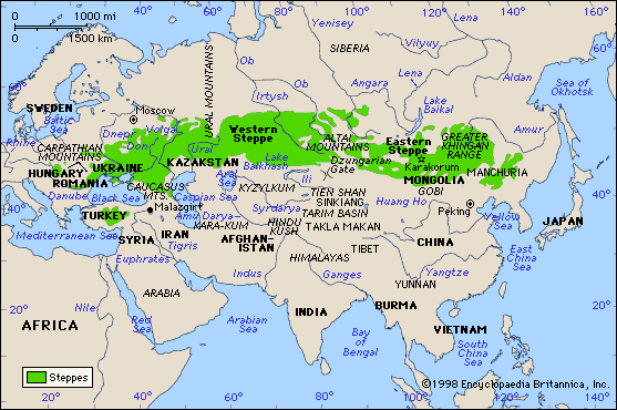
estepas-en-el-mundo-fuente-wikipedia.jpg
2014-01-14 16:38
42K
alisol-catena-fuente-blog-soils-and-environmant.jpg
2012-03-24 14:14
42K
solonetz-mapa-del-mundo-isric.jpg
2013-12-26 15:32
41K
o_Argentina Degradación Soc Rural Arg.jpg
2010-01-15 17:48
41K
nitisols-mapa-mundial-fao.jpg
2013-02-18 17:00
40K
pinguinos-guano-gs-de-la-rise-peque.jpg
2020-06-03 19:31
40K
o_Canarias Kalipedia.JPG
2010-01-15 17:48
40K
o_agricultura hace 2000 anos.JPG
2010-01-15 17:48
40K
o_Mapa de Suelos de Costa Rica.jpg
2010-01-15 17:48
39K
luvisoles-mapa-de-europa.jpg
2012-01-24 19:39
39K
escla-de-los-mapas-geografia-7%c2%ba-ano.jpg
2011-03-12 19:59
39K
escala-de-los-mapas-geografia-7-ano.jpg
2011-03-12 20:07
39K
o_tropic-map.jpg
2010-01-15 17:48
39K
o_Degradacion del Suelo Argentina.jpg
2010-01-15 17:48
39K
o_Degradación del Suelo en Argentina ONI Escuelas.jpg
2010-01-15 17:48
39K
o_Países incluídos en EUDiapositiva4.JPG
2010-01-15 17:48
38K
o_Argentina1.JPG
2010-01-15 17:48
38K
o_Wetlandsols USA.gif
2010-01-15 17:48
38K
o_world map glaciation.jpg
2010-01-15 17:48
38K
o_Clima Mediterráneo Distribución Mundial.gif
2010-01-15 17:48
38K
o_Urugauy degradación de tierras FAO.gif
2010-01-15 17:48
38K
o_Phaeozems mía.JPG
2010-01-15 17:48
37K
o_Erosion Hídrica más eólica eroshide.gif
2010-01-15 17:48
37K
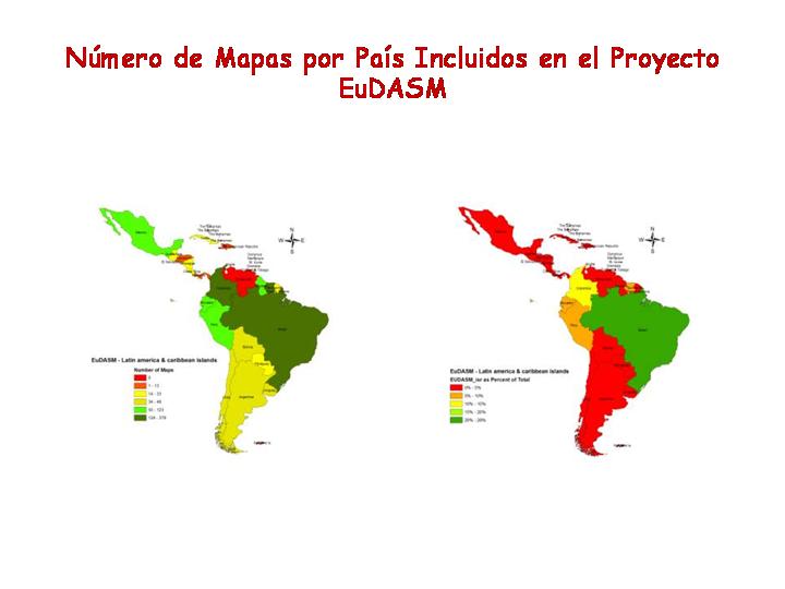
o_Numero de Mapas Latinoamerica EuDAMS.JPG
2010-01-15 17:48
37K
o_Biomas suelos tectomas 2.jpg
2010-01-15 17:48
36K
o_Incendios Portugal 1990-2004.jpg
2010-01-15 17:48
36K
o_Mapa mundial precipitaciones Kalipedia.png
2010-01-15 17:48
35K
gypsisol-mapa-de-suelos-europa-libro-suelos-de-europa-esb.jpg
2013-11-01 19:35
34K
solonetz-en-europa-fuente-esb.jpg
2013-12-30 15:42
34K
o_Diapositiva60.GIF
2010-01-15 17:48
34K
o_Pobrela Latinoamárica.jpg
2010-01-15 17:48
33K
leptsoles-mapa-del-mundo-wrb-1998-fuente-fao.gif
2010-07-13 14:54
33K
gypsisol-mapa-del-mundo-isric.jpg
2013-11-01 19:36
32K
o_escasez de Agua en Blog CAM EL Agua Febrero.JPG
2010-01-15 17:48
32K
ferralsoles-mapa-latinoamerica-esb.jpg
2013-02-23 15:49
32K
ferralsoles-mapa-latinoam%c3%a1rica-esb.jpg
2013-02-23 15:46
32K
mapa-de-los-cambisoles-en-el-mundo-fuente-fao.gif
2011-05-27 16:48
32K
o_Copia de Leyenda Mapa Biomas del Mundo 2.jpg
2010-01-15 17:48
32K
o_Balticopostclasical.jpg
2010-01-15 17:48
31K
o_Usos Suelo Rep Dominicana 1971.jpg
2010-01-15 17:48
31K
o_Zonas no perturbadas id26.gif
2010-01-15 17:48
31K
volcanes-y-tectonica-de-placas.jpg
2011-10-23 16:27
31K
o_permafrost_map.gif
2010-01-15 17:48
31K
o_Suelos Europa ESB.jpg
2010-01-15 17:48
30K
mapa-del-mundo-de-gleysoles-fuente-fao.gif
2011-01-30 15:00
30K
o_Acrisoles FAO ISRIC.gif
2010-01-15 17:48
30K
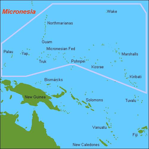
o_Micronesia.JPG
2010-01-15 17:48
29K
calcisol-mapa-del-mundo-fao.gif
2013-01-06 14:13
29K
cryosolsmap-fao.jpg
2012-07-09 16:24
29K
arenosoles-mapa-del-mundo.gif
2011-07-09 15:50
29K
mapa-del-mundo-de-los-regosoles-fuente-fao.gif
2010-08-11 17:41
29K
solonchaks-mapa-del-mundo-fao.gif
2013-11-22 16:07
29K
o_europa mapa geológico.gif
2010-01-15 17:48
29K
kastanozem-mapa-del-mundo.jpg
2014-04-08 13:24
28K
o_glasod_s.jpg
2010-01-15 17:48
28K
o_vertisol Isric.gif
2010-01-15 17:48
28K
o_Continentes dendrograma muy grande.jpg
2010-01-15 17:48
28K
o_ferralsoles ISRIC.gif
2010-01-15 17:48
28K
alisol-mapa-del-mundo.gif
2012-03-24 14:16
28K
vertisols-world-map-fao.gif
2011-08-09 15:33
28K
ferralsol-mapa-del-mundo-fao.gif
2013-02-20 19:42
27K
o_Histosoles Map.gif
2010-01-15 17:48
27K
histosoles-mapa-del-mundo-fuente-wrb-fao-1998.gif
2011-03-24 17:28
27K
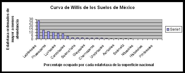
o_Curva Willis Suelos México WRB 2006.jpg
2010-01-15 17:48
27K
planosol-mapa-del-mundo-fao.gif
2012-07-30 15:57
27K
lixisol.gif
2012-03-29 15:57
27K
ferralsoles-en-la-celendario-2012-esb.jpg
2012-01-17 16:35
27K
podzol-mapa-mundial-fao.gif
2012-06-23 14:39
27K
o_Podzol Map FAO.gif
2010-01-15 17:48
27K
o_Continentes Árbol.JPG
2010-01-15 17:48
26K
o_steppes laurasia.gif
2010-01-15 17:48
26K
gypsisoles-mapa-del-mundo-fao.jpg
2013-11-01 19:40
26K
luvisoles-fao.gif
2012-01-09 16:14
26K
umbrisol-mapa-del-mundo.gif
2012-09-14 16:22
26K
o_Biomas del Brasil IBGE.gif
2010-01-15 17:48
26K
posidonia-mapa-de-distribcion-mundial-fuente-ufu-edu_.jpg
2012-06-07 14:53
26K
o_Grenada-CIA_WFB_Map.jpg
2010-01-15 17:48
26K
o_corrientes atlántico norte.jpg
2010-01-15 17:48
26K
o_phaeozem Isric.gif
2010-01-15 17:48
26K
o_Argentina3.JPG
2010-01-15 17:48
26K
andosol-mapa-del-mundo-isric.gif
2011-10-24 15:41
26K
acrisoles-en-la-calendario-esb-2012_0.jpg
2012-05-30 14:57
25K
acrisoles-en-la-calendario-esb-2012.jpg
2012-01-17 16:36
25K
cambisoles-en-la-calendario-2012-esb.jpg
2012-01-17 16:34
25K
o_gnv007-1.gif
2010-01-15 17:48
25K
durisol-mapa-del-mundo-fao.gif
2013-09-18 14:54
25K
acrisol-fao.gif
2012-05-28 16:16
25K
plinthosol-mapa-del-mundo.gif
2013-02-27 15:33
25K
o_México ajuste a una potencial.jpg
2010-01-15 17:48
25K
o_Albeluvisol FAO MAP.gif
2010-01-15 17:48
25K
albeluvisol-mapa-mundo-fao.gif
2012-06-15 20:52
25K
o_Escala y Edad de los Mapas en EuDAms.JPG
2010-01-15 17:48
25K
solonetz-mapa-la.jpg
2013-12-28 14:50
25K
o_Efecto Foehn.jpg
2010-01-15 17:48
25K
o_Tierra Nocge DBYN earth_lights.lr.jpg
2010-01-15 17:48
24K
o_Fao MUndo Cambio Global gnv6.gif
2010-01-15 17:48
24K
nitisoles-en-latinoamerica-calendario-esb.jpg
2013-02-18 21:05
24K
suelos-de-cuba-distribucion.jpg
2012-01-15 17:02
24K
o_Riesgos degradacion ISRIC.jpg
2010-01-15 17:48
24K
o_Reg Biogeog Table.jpg
2010-01-15 17:48
23K
calcisoles-en-latinoamerica.jpg
2013-01-06 14:17
23K
o_Argentina2.JPG
2010-01-15 17:48
23K
o_Mammaldiversitymap.gif
2010-01-15 17:48
23K
o_biomes.gif
2010-01-15 17:48
23K
o_Humedad humidity index.PNG
2010-01-15 17:48
22K
o_Montserrat-CIA_WFB_Map.jpg
2010-01-15 17:48
22K
o_andisoles en USA Mapa.jpg
2010-01-15 17:48
22K
o_Biomas del Mundo Leyemda 4.GIF
2010-01-15 17:48
22K
o_Paraguay Precipitaciones.gif
2010-01-15 17:48
22K
o_Biomas y Suelos Componentes Principales.gif
2010-01-15 17:48
21K
o_Continentes.jpg
2010-01-15 17:48
21K
phaeozem-mapa-del-mundo.jpg
2014-04-18 15:55
21K
phaeozens-en-latinoamerica-calendario-esb-2012.jpg
2012-01-17 16:38
21K
frabcisco-monturiol-in-memorian.jpg
2020-08-21 15:47
21K
chernozem-world-map-wikipedia.jpg
2014-01-14 16:38
21K
leptosoles-en-la-calendario-2012-esb.jpg
2012-01-17 16:32
21K
o_mapa suelo Trinidad Tobago.gif
2010-01-15 17:48
21K
o_Argentina4.JPG
2010-01-15 17:48
20K
andosoles-en-la-calendario-2012-esb.jpg
2012-01-17 16:33
20K
plintosoles-en-la-calendario-del-esb-2012.jpg
2012-01-17 16:36
20K
vertisoles-en-la-calendario-2012-esb.jpg
2012-01-17 16:33
20K
o_Islas Virgenes guarida piratas.gif
2010-01-15 17:48
19K
solonetz-en-la-calendario-2012-esb.jpg
2012-01-17 16:40
19K
nitisoles-en-la-calendario-2012-esb.jpg
2012-01-17 16:39
19K
calcisoles-en-la-calendario-esb.jpg
2012-01-17 16:37
19K
paleosuelo-sepultado-por-loess-fuente-unam.jpg
2012-01-09 16:15
19K
o_Bioclimate map encarta.gif
2010-01-15 17:48
19K
o_Argentina Susana4.png
2010-01-15 17:48
19K
o_Sat Vicente y Granadina Wikiesp.JPG
2010-01-15 17:48
18K
o_Copia de world_biomes_map.gif
2010-01-15 17:48
18K
o_Copia (2) de world_biomes_map.gif
2010-01-15 17:48
18K
o_Baltic_Sea.jpg
2010-01-15 17:48
18K
o_Virgin_islands_USA.JPG
2010-01-15 17:48
17K
o_Secutro carbono a 1m mapamundo.gif
2010-01-15 17:48
17K
o_Mapa Antillas.gif
2010-01-15 17:48
16K
o_fao_world.GIF
2010-01-15 17:48
16K
phaeozem-mapa-la.jpg
2014-04-19 15:07
16K
o_Relieve de Argentina ingeodav fce n uba.jpg
2010-01-15 17:48
15K
o_cd-1.jpg
2010-01-15 17:48
15K
o_Antigua y Barbuba.jpg
2010-01-15 17:48
14K
tipo-de-escalas-graficas-fuente-recursos-educativos.jpg
2011-03-12 20:00
14K
o_Saint_Kitts_and_Nevis-CIA_WFB_Map.JPG
2010-01-15 17:48
14K
o_Argentina5.JPG
2010-01-15 17:48
14K
o_América Austral.jpg
2010-01-15 17:48
14K
o_Pangea Wikipedia Español.JPG
2010-01-15 17:48
14K
o_Cayman_Islands-CIA_WFB_Map.jpg
2010-01-15 17:48
14K
o_Ecoregiones del Mundo Bailey.gif
2010-01-15 17:48
14K
o_Biomas Mundo Leyenda.gif
2010-01-15 17:48
13K
lixisoldistriamer-fuente-unex.jpg
2012-03-29 15:59
13K
o_Limiteconvergente Wikipedia.JPG
2010-01-15 17:48
13K
o_Limiteconvergente-continenteycontinente Wikipedia.JPG
2010-01-15 17:48
13K
vertisol-catena-fao.gif
2011-08-09 15:32
13K
o_Guadeloupe Wikipedia Francess.JPG
2010-01-15 17:48
12K
o_Antigua y Barbuda_ WikiEspañol.JPG
2010-01-15 17:48
12K
o_BIOMES busqueda Google.gif
2010-01-15 17:48
11K
o_zoogeografía de Argentina.gif
2010-01-15 17:48
9.9K
o_climaMantos Glacies Portalciencia.jpg
2010-01-15 17:48
9.6K
o_Guadalupe Martinica Dominca Wiki UK.JPG
2010-01-15 17:48
8.6K
o_Biomas del Mundo Leyenda3.gif
2010-01-15 17:48
8.6K
o_Logo ESBN Luca Junio.GIF
2010-01-15 17:48
7.3K
o_Suelos sódicos en el mundo2.gif
2010-01-15 17:48
6.5K
o_Suelos salinos en el mundo almap1.gif
2010-01-15 17:48
5.6K
o_Libro Ecozones of The World 147768.jpg
2010-01-15 17:48
5.4K
o_96452.jpg
2010-01-15 17:48
5.4K
o_colision Juan Carlos Rana.gif
2010-01-15 17:48
5.3K
o_LocationNetherlandsAntilles.JPG
2010-01-15 17:48
4.7K
o_Biomas Brasil IBGE Tabla.gif
2010-01-15 17:48
4.0K
o_subduccion Juan carlos Rana.gif
2010-01-15 17:48
3.8K
escala-numerica-y-escalas-graficas-fuente-club-de-exploradores.gif
2011-03-12 20:00
2.8K
o_header_nrcs.gif
2010-01-15 17:48
2.7K
o_cabono suelosmapa mundo leyenda_CarbonSoils_key.gif
2010-01-15 17:48
2.3K
o_cabono suelosmapa mundo leyenda.gif
2010-01-15 17:48
2.3K
thumbs/
2025-02-24 13:32
-
Apache/2.4.41 (Ubuntu) Server at www.madrimasd.org Port 80
%20de%20world_biomes_map.gif)